Italy's Farm Subsidy Agency Hires a Satellite and Aerial Photography Consortium to Photograph the Entire Country
Standfirst
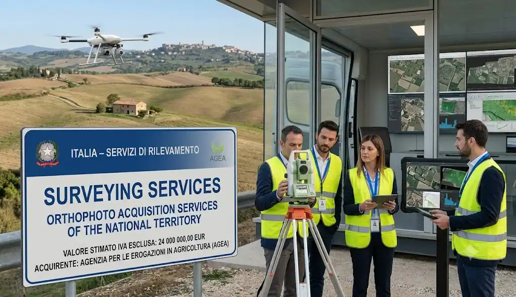
AGEA, the Italian agency responsible for paying out EU agricultural subsidies, has awarded a EUR 24 000 000 contract to acquire orthophotos of Italy's entire national territory to a consortium combining satellite imaging specialist e-GEOS and aerial survey veteran Compagnia Generale Riprese Aeree. The four-year contract underpins how Italy verifies farmland claims under the EU's Common Agricultural Policy.
Introduction
Before Brussels sends a euro of farm subsidy money to an Italian farmer, someone has to confirm the land being claimed actually looks the way the paperwork says it does. That verification increasingly happens from the air and from orbit, using precisely geo-referenced aerial photographs known as orthophotos, corrected for terrain and camera distortion so every pixel maps accurately onto real world coordinates.
AGEA, Italy's Agricultural Payments Agency, has just secured four years of that imagery for the whole country, awarding the work to a consortium built specifically around the two disciplines the job demands: satellite and remote sensing expertise from e-GEOS and decades of aerial photography experience from Compagnia Generale Riprese Aeree.
Why This Contract Matters
Orthophoto acquisition sits at the technical core of how EU member states administer the Common Agricultural Policy's Integrated Administration and Control System, the mechanism used to verify that farmland subsidy claims match reality on the ground. Accurate, up to date imagery of Italy's entire national territory is what allows AGEA to detect discrepancies, prevent fraudulent claims and ensure EU farm payments reach the land they are meant to support.
A four year, nationwide contract of this kind is also a meaningful commitment to consistent methodology. Rather than commissioning imagery piecemeal, AGEA has locked in a single technical partner for the full term, giving it a stable, comparable dataset to work from as it processes subsidy applications year after year.
Contract Timeline
- Procedure type: Open procedure under Directive 2014/24/EU
- Winner selected: 25 May 2026
- Contract concluded: 22 July 2026
- Notice dispatched to the Publications Office: 18 August 2026
- Published in the Official Journal, OJ S 159/2026: 19 August 2026
- Contract duration: 48 months
Contract Overview
AGEA ran an open procedure for services to acquire orthophotos covering Italy's entire national territory, structured as a framework agreement without reopening of competition, meaning a single winning supplier holds the work for the full contract term. Three tenders were received and the contract was awarded to a consortium formally registered as IRS Italian Remote Sensing, e-GEOS S.p.A. and Compagnia Generale Riprese Aeree S.p.A., with an estimated and maximum framework value of EUR 24 000 000 over 48 months.
The winning tender includes subcontracting, disclosed at 20 percent of the contract, though the specific monetary value of that subcontracted portion is not disclosed in the notice.
Key Contract Details
| Contracting authority | Agenzia per le Erogazioni in Agricoltura AGEA |
| Contract title | Open procedure for the acquisition of orthophotos of the national territory |
| CPV code | 71355000, Surveying services |
| Procedure type | Open procedure |
| Legal basis | Directive 2014/24/EU |
| Estimated and maximum framework value | EUR 24 000 000, excluding VAT |
| Contract duration | 48 months |
| Award criteria | Economically most advantageous tender, quality based, no numeric weighting disclosed |
| Tenders received | 3 |
| Winner | IRS Italian Remote Sensing - e-GEOS S.p.A. - Compagnia Generale Riprese Aeree S.p.A. |
| Subcontracting | Yes, 20 percent of contract value, monetary amount not disclosed |
| Winner selected | 25 May 2026 |
| Contract signed | 22 July 2026 |
| GPA coverage | No |
| EU funding | No |
| Framework structure | Framework agreement without reopening of competition |
| Review body | TAR Roma Lazio (Lazio Regional Administrative Court), 30 day review deadline |
| Notice reference | 574814 2026, OJ S 159/2026, published 19 August 2026 |
Project Scope
The contract covers the acquisition of orthophotos, geometrically corrected aerial photographs accurately aligned to real world coordinates, across the whole of Italy's national territory over the four year contract term. The notice does not detail flight campaign schedules, resolution specifications or delivery formats, directing that level of technical detail to the underlying tender documentation. Given AGEA's role as Italy's paying agency for EU farm subsidies, this imagery is understood to support verification of agricultural land use declarations under the Common Agricultural Policy's control systems.
About the Contracting Authority
Agenzia per le Erogazioni in Agricoltura AGEA is a central government authority based in Rome, active in general public services. AGEA is Italy's national paying agency for European Union agricultural subsidies, responsible for disbursing Common Agricultural Policy payments to Italian farmers and for the control and verification systems, including geospatial monitoring, that ensure those payments are properly justified.
About the Organisations Involved
Agenzia per le Erogazioni in Agricoltura AGEA
As covered above, AGEA is the buyer for this contract and is also the organisation providing further information on review procedures.
TAR Roma Lazio
The Lazio Regional Administrative Court, based in Rome, is named as the review organisation for this contract, the standard venue for challenges to Italian central government procurement decisions, with a 30 day review deadline specified in the notice.
IRS Italian Remote Sensing - e-GEOS S.p.A. - Compagnia Generale Riprese Aeree S.p.A.
The winning consortium, registered under a single joint name and based in Parma, combines three distinct technical identities. e-GEOS S.p.A. is a well established Italian satellite Earth observation and geospatial services company, a joint venture between Telespazio, itself part of the Leonardo and Thales aerospace groups and the Italian Space Agency, known for operating and exploiting data from Italy's COSMO-SkyMed satellite constellation. Compagnia Generale Riprese Aeree S.p.A., commonly known as CGR, is one of Italy's longest established aerial photography and photogrammetry companies, with a decades long track record in national territorial mapping and survey work. IRS Italian Remote Sensing completes the consortium's remote sensing capability. Together, the grouping combines satellite based and traditional aerial imaging expertise under a single contracting entity.
Procurement Analysis
AGEA ran a standard open procedure, evaluated on an economically most advantageous tender basis, a quality inclusive standard common in Italian public procurement for technically complex services, though the notice does not disclose the specific price to quality weighting applied. Three tenders were received, a reasonable competitive field for a nationwide geospatial survey contract of this technical specificity, where relatively few consortiums combine both the satellite and aerial photography capability needed to credibly bid.
The framework operates without reopening of competition, giving the winning consortium exclusive responsibility for delivering orthophoto coverage of the entire country across the full four year term, rather than sharing the work with other suppliers through ongoing mini-competitions. The disclosed 20 percent subcontracting share suggests the winning consortium will bring in additional specialist capacity for part of the delivery, though which specific tasks are subcontracted is not stated.
Additional Procurement Facts
- This contract is confirmed as not financed with EU funds and as not covered by the Government Procurement Agreement.
- No dynamic purchasing system applies to this contract.
- The subcontracting percentage is disclosed at 20 percent, though the corresponding monetary value is not known or not disclosed.
Market and Industry Perspective
Nationwide orthophoto and aerial survey contracts of this kind sit at the intersection of Italy's space and geospatial technology sector and its more traditional aerial survey industry and this award brings together leading representatives of both. e-GEOS's position within the Telespazio, Leonardo, Thales and Italian Space Agency ecosystem gives the consortium access to sophisticated satellite based Earth observation capability, while CGR's long domestic track record in aerial photography grounds the bid in decades of practical national mapping experience.
Contracts of this scale and duration are relatively rare and winning one secures a supplier a substantial, stable revenue stream while also embedding it deeply in the technical infrastructure underpinning Italy's agricultural subsidy administration for years to come.
Economic Significance
At EUR 24 000 000 over four years, this is a substantial commitment to maintaining the geospatial data infrastructure that supports EU farm subsidy verification across Italy, an investment that ultimately protects the integrity of a much larger flow of Common Agricultural Policy payments to Italian farmers.
Future Procurement Opportunities
With no reopening of competition and a fixed 48 month term, this contract will need to be retendered in full once its term concludes, likely around 2030, offering other geospatial and remote sensing consortiums a future opportunity to compete for Italy's national orthophoto acquisition work.
Opportunities for Suppliers
Satellite imaging, remote sensing and aerial survey firms should note the consortium model demonstrated by this award, pairing satellite and traditional aerial photography capability under a single bid, as a credible template for competing in future nationwide geospatial survey tenders across Italy and other EU member states running comparable Common Agricultural Policy monitoring programmes.
What Businesses Should Watch
- Delivery milestones and coverage progress as the consortium executes the four year national orthophoto programme.
- Comparable orthophoto and geospatial monitoring tenders from other EU member states' agricultural paying agencies.
- Broader integration of satellite based Earth observation data, including Copernicus Sentinel imagery, into EU agricultural subsidy verification systems over time.
ItalyTenders.com Procurement Intelligence
This award is a clear example of how EU agricultural policy administration depends on genuinely sophisticated geospatial infrastructure behind the scenes. Verifying farm subsidy claims across an entire national territory requires precise, consistently updated imagery and the consortium structure AGEA selected here, pairing satellite expertise with aerial survey depth, reflects the technical breadth that kind of national scale monitoring now demands.
For firms in the Earth observation and aerial survey space, the strategic lesson is that nationwide agricultural monitoring contracts increasingly reward combined satellite and aerial capability under a single bid, rather than either discipline competing alone. Companies positioning for similar tenders elsewhere in the EU, where every member state's paying agency faces the same Common Agricultural Policy verification requirement, should treat cross-disciplinary consortium formation as a competitive necessity rather than an optional strategy.
Looking ahead, as satellite based monitoring technology continues to mature and Copernicus data becomes more central to EU agricultural oversight, contracts like this one may increasingly shift in balance between aerial and satellite acquisition methods, a dynamic worth watching for any supplier with a stake in Europe's agricultural monitoring infrastructure market.
Supplier Takeaways
- This nationwide orthophoto contract was won by a consortium combining satellite remote sensing and traditional aerial photography expertise, a model worth replicating for similar tenders.
- Three tenders competed for the work, indicating a moderately sized but genuinely specialised competitive field.
- The winning consortium disclosed 20 percent subcontracting, suggesting room for specialist subcontractor involvement in large geospatial survey contracts of this kind.
- The framework runs without reopening of competition, giving the winner exclusive responsibility for the full four year term.
- EU member state agricultural paying agencies represent a recurring, specialised market for nationwide geospatial survey and monitoring services.
Key Takeaways
- AGEA awarded a EUR 24 000 000, four-year contract for national orthophoto acquisition to a consortium of IRS Italian Remote Sensing, e-GEOS and Compagnia Generale Riprese Aeree.
- The contract supports AGEA's verification of farmland claims under the EU's Common Agricultural Policy.
- Three tenders were received under an open procedure evaluated on an economically most advantageous tender basis.
- The winning tender includes 20 percent subcontracting, with the monetary value undisclosed.
- The contract is not financed with EU funds and operates as a single supplier framework without reopening of competition.
- The contract runs 48 months from its conclusion date of 22 July 2026.
Conclusion
Behind every farm subsidy payment Italy makes under the EU's Common Agricultural Policy sits a quiet infrastructure of aerial and satellite imagery and AGEA has just secured four more years of it from a consortium built specifically to combine both disciplines. It is not a headline grabbing contract, but it is the kind of technical groundwork that determines whether billions of euro in European farm payments actually reach the land they are meant to support.
Source: Tenders Electronic Daily (TED), Contract Award Notice 574814-2026, Official Journal of the European Union, OJ S 159/2026, published on 19 August 2026.
Frequently Asked Questions (FAQs)

Fresh and verified Tenders from Italy. Find, search and filter Tenders/Call for bids/RFIs/RFPs/RFQs/Auctions published by the government, public sector undertakings (PSUs) and private entities.
- 1,000+ Tenders
- Verified Tenders Only
- New Tenders Every Day
- Tenders Result Data
- Archive & Historical Tenders Access
- Consultants for RFI/RFP/RFQ
- Tender Notifications & Alerts
- Search, Sort, and Filter Tenders
- Bidding Assistance & Consulting
- Customer Support
- Publish your Tenders
- Export data to Excel
- API for Tender Data
- Tender Documents

Fill out the form below and you will receive a call from us within 24 hours.
Get FREE SAMPLE TENDERS from Italy in your email inbox.
Copyright © 2014-2026 ItalyTenders.com. All Rights Reserved.